
Chakwali Gurez
Overview
The road to Chakwali ends at a meadow. Beyond that meadow, there’s a stream. Beyond that stream, there’s Pakistan. Chakwali is the last civilian point you can reach in Gurez Valley before the Line of Control. The road literally stops here. No more asphalt. No more villages. Just mountains, the Kishanganga River, and the border. On clear days, you can see Pakistani villages across the valley. On cloudy days, you can’t see past the next ridge. Either way, you’re standing at the edge of India.
This is what people come to Chakwali for. Not the village itself, though it’s beautiful in its own quiet way, but the feeling of being at the end of the map. The last settlement before civilian access stops and military zones begin.
Chakwali sits 65 kilometers from Dawar, the main town in Gurez Valley. The first 10 kilometers are paved. The remaining 55 kilometers are dirt, rocks, potholes, and stream crossings. The drive takes 4-5 hours one way if you’re lucky. Longer if it rained recently. A full day trip from Dawar.
Most tourists who visit Gurez never make it to Chakwali. They stay in Dawar, see Habba Khatoon Peak, walk by the Kishanganga, and drive back to Srinagar. Chakwali requires an extra day, a permit from Dawar police station, and a vehicle with high ground clearance. It’s not for everyone. But if you want to see Gurez beyond the postcard version, this is where you go.
Also try to visit: Panikhar Warwan Valley
Gurez Valley Tours

3D/ 2N
6D/ 5N

10D/ 9N
5D/ 4N
Why Visit Chakwali
Chakwali doesn’t have monuments or tourist attractions. There’s no cafe, no viewpoint with railings, no selfie spots. What it has is remoteness. You’re 190 kilometers from Srinagar. 65 kilometers past Dawar. 127 kilometers past Bandipora. There’s no mobile network except patchy BSNL. No shops. No restaurants. The village has maybe 30-40 wooden houses clustered near the Kishanganga. The people are Dard-Shin, same as the rest of Gurez. They speak Shina and Kashmiri. Most have never left the valley.
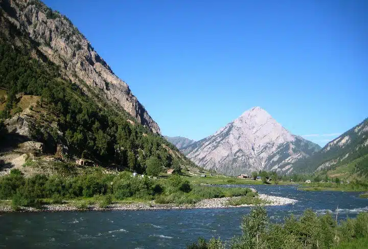
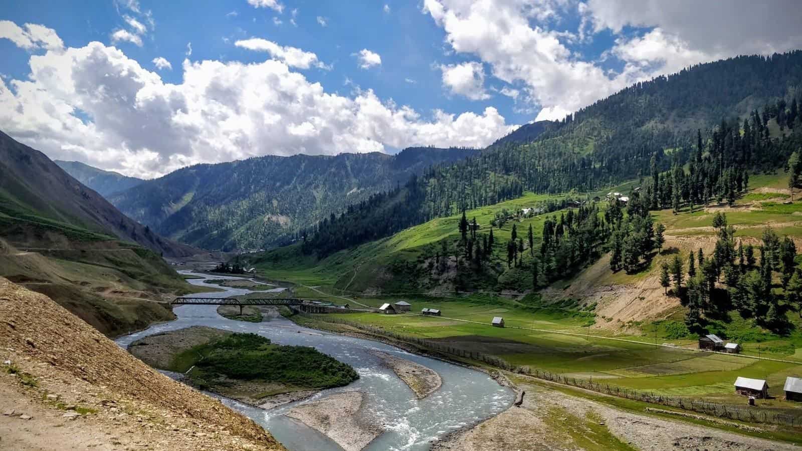
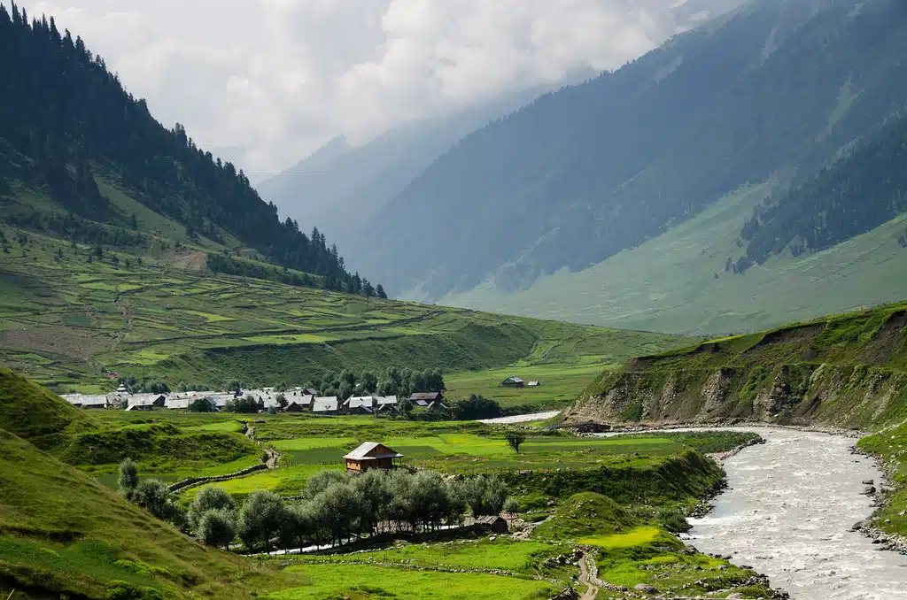
The landscape is what makes Chakwali worth the drive. The Tulail region between Dawar and Chakwali is the rawest part of Gurez. No development. No construction. Just small villages, pine forests, open meadows, and the river cutting through the valley floor.
The road runs parallel to the Kishanganga. Sometimes you’re 20 feet above it. Sometimes you’re driving through a streambed because the road washed out and this is what’s left. The mountains rise on both sides, steep, green in summer, snow-covered at the peaks. You pass through villages with names like Barnoi, Sheikhpora, Tulail, Badugam, Hasangam. Each one looks like the previous one. Log houses. Stone fences. Cattle grazing. Children playing cricket in meadows.
At Chakwali, the road ends. There’s a meadow where you can park. A stream runs through it. Beyond that, the terrain gets rougher. There’s a trekking route to Drass (closed to civilians). There’s the border (off-limits). And there’s the view.
On one side, you see mountains that are in Pakistan-occupied Kashmir. The Line of Control runs somewhere between you and those peaks. Army posts are stationed nearby, watching. On the other side, you see the valley you just drove through, stretching back toward Dawar. The perspective changes when you’re standing at the end of the road looking back.
People say it’s an “experience” to visit Chakwali. That’s vague but accurate. It’s not about seeing something specific. It’s about going to a place that feels like the edge of something.
For snowfall, read here about: Places to Visit in Kashmir in December
Chakwali Village and Culture
Chakwali’s original name was Chak-i-Bahaar. Locals still use both names.
The village has around 30-40 houses. Population is maybe 200-250 people. Everyone knows everyone. Most families have lived here for generations. They’re Dard-Shin, an ethnic group distinct from Kashmiris. They speak Shina as their first language, Kashmiri as second, and some Urdu or Hindi from interactions with army personnel and occasional tourists.
The houses are built from logs and mud. The logs are interlocked without nails—traditional Dard-Shin construction that’s designed to withstand earthquakes and heavy snow. The roofs are sloped. The walls are thick. Most houses have small windows to keep heat in during winter.
Life here is agricultural. People grow potatoes, barley, vegetables. They keep livestock—cows, goats, sheep. The land is fertile near the river. The growing season is short because of altitude and winter closure. Families produce what they consume. There’s no market in Chakwali. If you need something from outside, you go to Dawar.
Winter cuts Chakwali off from the rest of the world. Razdan Pass closes in November. Snow blocks the road from Dawar to Chakwali. The village is isolated for 5-6 months. Families stock up on essentials, rice, flour, kerosene, medicines—before winter sets in. The army maintains a post here year-round and has helicopter access for emergencies.
The people are hospitable. If you stop in the village and locals see you, they’ll invite you for tea. Kahwa, the traditional Kashmiri tea with saffron and almonds. The conversation might be limited if you don’t speak Shina or Kashmiri, but the gesture is genuine. Hospitality is cultural here, not commercial.
Kashmir Offbeat Tours

14D/ 13N
6D/ 5N

16D/ 15N
12D/ 11N
Dawar to Chakwali: The Road
The drive from Dawar to Chakwali is 65 kilometers. On a normal road, that’s an hour. Here, it’s 4-5 hours each way.
First 10 Kilometers: Paved
The road out of Dawar is decent. Asphalt, wide enough for two vehicles. You pass through the outskirts of Dawar, then open meadows. The Kishanganga River is on your left. Mountains on both sides. This section takes 20-30 minutes.
Remaining 55 Kilometers: Dirt and Rock
After 10 kilometers, the pavement ends. What follows is a dirt trail that’s been chewed up by trucks, washed out by rain, and repaired haphazardly with gravel and stones. The “road” is more like a suggestion.
The surface is uneven. Rocks stick up. Potholes are deep enough to bottom out a sedan. Some sections have loose gravel that slides under tires. Other sections are mud when it rains. A few sections require driving through shallow streams because the road follows the riverbed.
The road is narrow. One vehicle wide in most places. When two vehicles meet head-on, one has to reverse to a wider section to let the other pass. This happens multiple times during the drive.
The road climbs and descends. Not dramatically, but enough that you’re constantly shifting gears. First gear for steep climbs. Second gear for flats. The gradient isn’t steep, but the surface is so broken that speed stays under 20 km/h most of the time.
There are no guardrails. In some places, the road runs along a cliff edge with the Kishanganga River 30-40 feet below. In other places, the road cuts through forest so dense you can’t see more than a few meters ahead. Villages appear every few kilometers: Barnoi, Sheikhpora, Purana Tulail, Badugam, Hasangam, Baduab, Miru, Angaikot, Gujran. Each village is 20-30 houses clustered together. Log houses with sloped roofs. Stone walls around vegetable patches. Cattle tied near the houses. Kids playing outside.
Between villages, it’s wilderness. Pine forests. Open meadows. The river. Mountains. You’ll see shepherds grazing goats. You’ll see women carrying firewood. You’ll see military trucks heading to forward posts.
Army checkpoints appear at intervals. You stop, show ID, get registered, move on. The soldiers are polite. They’re stationed here for months at a time, rotating in and out. They know this road better than anyone.
Chakwali End Point
The road ends at a meadow. There’s space to park 10-15 vehicles. A stream runs through the meadow. Beyond the stream, there’s a dirt path that leads to the army post, but civilians aren’t allowed past this point.
This is where people get out, stretch, take photos, walk around. The mountains in front are in Pakistan-occupied Kashmir. The Line of Control is somewhere between here and those peaks. You can’t see the border, but you know it’s there.
Return Drive
The return drive is the same 4-5 hours. Same rough road. Same checkpoints. By the time you get back to Dawar, you’re exhausted, dusty, and either exhilarated or regretting the decision. Usually both.
Vehicle Requirements
- SUVs work best: Bolero, Thar, Scorpio, Sumo, XUV. High ground clearance is essential.
- Sedans and hatchbacks won’t make it. The undercarriage will hit rocks. The suspension will take a beating.
- Motorcycles can do it, but it’s rough. You need experience riding on broken terrain.
- Self-drive is possible if you’re confident. Otherwise, hire a local driver who knows the road.
Permit Required for Chakwali
Yes. You need a permit to travel beyond Dawar to Tulail and Chakwali.
Why Permits are Required:
Chakwali is close to the Line of Control. The area is under army surveillance. Permits ensure that only civilians with valid IDs enter the region and that the army knows who’s traveling through sensitive zones.
How to Get the Permit:
For Indian Citizens:
- Go to the Police Station in Dawar (near the main market)
- Carry original Aadhar Card (mandatory—other IDs like Voter ID, PAN, Driving License don’t work)
- Carry 2 passport-size photos
- Carry photocopies of Aadhar Card (2-3 copies for submission at checkpoints)
- Permit is issued on the spot—takes 30 minutes to 1 hour depending on how many people are applying
- No fee for the permit
For Foreign Nationals:
- Foreigners are not allowed to visit Chakwali as of 2024
- The region is too close to the border, and security restrictions prohibit foreign tourists from entering Tulail and Chakwali
- Foreign tourists can visit Gurez up to Dawar but cannot go beyond
Best Time to Visit Chakwali Gurez
Chakwali is accessible only when Razdan Pass is open. That’s May to October. Outside this window, forget it.
Summer (May to September): Only Window
- Temperature: 10°C to 25°C
- This is when Chakwali is accessible. Roads are clear. Weather is pleasant. Rivers are full from snowmelt. Meadows are green.
- June to August is peak season. Tourist numbers are still low because most people don’t make it past Dawar, but the road is busiest during these months.
- May and September are quieter. Weather is slightly colder but still comfortable. Fewer tourists.
Monsoon (July to August): Risky
- Rain makes the dirt road worse. Mud. Slippery sections. Stream crossings become deeper.
- Landslides are possible between Dawar and Chakwali, though less common than on Razdan Pass.
- If it’s been raining for 2-3 days, check road conditions before attempting the drive.
Autumn (October): Last Chance
- October is the last month before Razdan Pass closes.
- Weather gets colder. Early snowfall can happen by mid-October.
- Tourist crowds are gone. The valley is quieter. Colors change—meadows turn golden, trees turn brown.
- If Razdan Pass closes early due to unexpected snow, you’re cut off from Srinagar. Plan accordingly.
Winter (November to April): Closed
- Razdan Pass closes. Gurez is cut off from the outside world.
- Chakwali is inaccessible even from Dawar because snow blocks the dirt road.
- Only army personnel remain, with helicopter access for emergencies.
- Do not plan a Chakwali trip in winter. It’s not possible.
Spring (April): Uncertain
- Razdan Pass usually opens in late April, but it depends on snowmelt.
- The road from Dawar to Chakwali might still have snow patches in early May.
- Check with locals or tour operators before planning a trip in April or early May.
Also read here about: Best time to visit Gurez Valley
For Chakwali, book between June and September. That’s the safe window.
Where to Stay: No Accommodation in Chakwali, you have to stay in Dawar.
Accommodation in Dawar: Dawar has 10-15 hotels and guesthouses. Prices range from ₹2,500 to ₹7,000 per night. Options include Kaka Palace, Wood Vibes, Grand Gurez, Gurez Inn, Pine Tree Resort, and several homestays. All bookings are best done through travel agents or direct phone calls. (See our Gurez Valley Hotels guide for details.)
What to Do in Chakwali
Chakwali isn’t about activities. It’s about being there.
- Stand at the End of the Road: The road ends at a meadow. Park. Get out. Walk around. This is as far as you can go as a civilian. Beyond this is the army post and restricted zones. The feeling of being at the edge is the main draw.
- See the Line of Control (from a Distance): You can’t see the actual border fence, but you can see Pakistani territory. The mountains across the valley are in Pakistan-occupied Kashmir. Army personnel will point out landmarks if you ask politely. Don’t photograph anything near army posts or in the direction of the border without asking.
- Walk by the Kishanganga River: The river runs through the meadow at Chakwali. The water is crystal clear, freezing cold, turquoise from glacier melt. You can walk along the bank, sit on rocks, dip your feet (if you can handle the cold).
- Interact with Locals: If you walk into the village (it’s a short walk from the end-of-road meadow), you’ll see people going about their day.
- Photography: The drive to Chakwali offers endless photo opportunities. Villages. Meadows. Mountains. The Kishanganga. Traditional log houses. Shepherds. Cattle. The landscape here is raw and untouched.
Things to Carry for Chakwali Trip
Documents:
- Original Aadhar Card (mandatory for permit)
- 2 passport photos
- Photocopies of Aadhar (2-3 copies)
- Any existing Gurez permit (if you already have one)
Clothing:
- Warm layers (mornings and evenings are cold even in summer)
- Windproof jacket (weather changes fast)
- Comfortable shoes with good grip (for walking on uneven ground)
- Cap or hat (sun is strong at high altitude)
- Sunglasses
Food and Water:
- Packed breakfast or snacks (no food available after Dawar)
- 2-3 liters of water per person
- Energy bars or dry fruits for the drive
Electronics:
- Fully charged phone
- Power bank (no charging on the way)
- Camera with extra batteries
- Offline maps downloaded (Google Maps works offline if downloaded)
Medical:
- Basic first aid kit
- Personal medications
- Motion sickness tablets (the road is rough)
- Sunscreen (UV is strong)
- Lip balm
Vehicle Essentials:
- Spare tire (check condition before leaving)
- Jack and wrench
- Full fuel tank
- Drinking water for the vehicle (in case of overheating)
Cash:
- No ATMs after Dawar
- Army may sell tea or snacks at checkpoints (₹20-50 per item)
- Keep small change for emergencies
Chakwali vs Other Border Villages in India
Chakwali is one of several “last villages” in India near international borders. Here’s how it compares:
Mana (Uttarakhand – China Border): Mana is better developed for tourism. Paved road all the way. Homestays available. More commercialized. Chakwali is rawer and less touristy.
Chitkul (Himachal Pradesh – China Border): Chitkul is a popular tourist destination. Good road access. Hotels and cafes. Crowds in peak season. Chakwali has none of that. It’s isolated and uncommercial.
Turtuk (Ladakh – Pakistan Border): Turtuk is accessible via a decent road. It has guesthouses, shops, and tourist infrastructure. Chakwali has almost no infrastructure.
Nathu La (Sikkim – China Border): Nathu La is a border pass with military presence and organized tourism. Chakwali is a village at the end of a dirt road with no organized tourism.
What Makes Chakwali Unique:
- It’s the last village in one of India’s most remote valleys (Gurez)
- The road is terrible, which keeps tourist numbers low
- It’s near the Line of Control (active military zone), not just an international border
- There’s zero commercial development—no shops, no cafes, no hotels
- The Dard-Shin culture is distinct from mainstream Kashmiri culture
Chakwali isn’t for people who want comfortable border tourism. It’s for people who want to see what “last village” actually means when there’s no infrastructure built around it.
Why Book Chakwali Trip with Cliffhangers
Chakwali isn’t a place you can casually visit. It requires permits, a capable vehicle, local knowledge, and a full day committed to rough driving. Cliffhangers makes this easier.
- Permit Handling: We collect your Aadhar details and photos before the trip. We process the Chakwali permit at Dawar Police Station. You don’t stand in line. We hand you the permit before you leave Dawar.
- Vehicles and Drivers: We provide SUVs (Bolero, Scorpio, Thar) with experienced local drivers who know the Dawar-Chakwali road. They’ve driven it dozens of times. They know where the bad sections are, when to slow down, and how to handle stream crossings.
- Army Checkpoint Coordination: Our drivers are familiar with the army checkpoints between Dawar and Chakwali. They know what documents to show, what questions to answer, and how to move through quickly without delays.
- Safety Backup: If your vehicle breaks down or gets stuck, we have local contacts who can assist. If weather changes and the road becomes impassable, we reroute you or arrange stays in Dawar until conditions improve.
- Package Deals: Chakwali trips are usually part of a larger Gurez Valley package (3-5 days). We handle transport from Srinagar to Gurez, accommodation in Dawar, permits for both Gurez and Chakwali, meals, and local guides. One booking covers everything.
- Local Knowledge: Our guides and drivers are from Kashmir. They speak Kashmiri and Urdu. They can interact with locals in villages, arrange tea stops with families, and explain the culture and history as you drive.
- 24/7 Support: If something goes wrong, medical emergency, vehicle issue, security concern, call us. We have on-ground support in Gurez and can coordinate with local authorities or army personnel if needed.
FAQ's
Is Chakwali safe to visit?
Yes. Chakwali is safe for Indian tourists. The area is under constant army surveillance due to its proximity to the Line of Control. Security is tight. Tourists face no threats. Follow local guidelines, don’t enter restricted zones, and you’ll be fine.
Can foreigners visit Chakwali?
No. As of 2024, foreign nationals are not allowed to visit Chakwali or any area beyond Dawar in Gurez Valley due to security restrictions near the Line of Control. Only Indian citizens with valid IDs can visit.
Do I need a permit to visit Chakwali?
Yes. You need a permit issued by Dawar Police Station. The permit is free and issued on the spot to Indian citizens who present an original Aadhar Card and passport-size photos. Cliffhangers handles permit processing if you book a tour package.
How long does it take to reach Chakwali from Dawar?
4-5 hours one way. The distance is 65 km, but the road is dirt, rocks, and potholes for 55 km. Average speed is 15-20 km/h. A full day trip (morning to evening) is required to visit Chakwali and return to Dawar.
Can I stay overnight in Chakwali?
No. Chakwali has no hotels, guesthouses, or homestays. Everyone stays in Dawar and visits Chakwali as a day trip. Camping overnight in Chakwali requires special army permission, which civilians rarely get.
What type of vehicle is needed for Chakwali?
SUVs with high ground clearance (Bolero, Scorpio, Thar, Sumo). Sedans and hatchbacks cannot handle the broken road. The undercarriage will hit rocks, and the suspension will fail. Motorcycles can make it but require experience riding on rough terrain.
Is mobile network available on the way to Chakwali?
No. BSNL has patchy coverage in a few spots, but most of the drive has zero signal. Jio works only in Dawar. Once you leave Dawar, expect no connectivity until you return. Inform someone about your travel plans before leaving.
Can I see Pakistan from Chakwali?
Yes. The mountains across the valley are in Pakistan-occupied Kashmir. The Line of Control runs between Chakwali and those peaks. You can see Pakistani territory from Chakwali, but you cannot see the actual border fence. Photography toward the border requires caution—ask army personnel before photographing.
What is the best time to visit Chakwali?
June to September. Chakwali is accessible only when Razdan Pass is open (May to October), but the Dawar-Chakwali road is best in summer. Avoid monsoon months (July-August) if it’s been raining heavily, as the dirt road becomes muddy and dangerous.
 Call Now
 Chat With Us